All ecosystems in PKOLS – Mount Douglas are considered ecosystems at risk to protect these fragile systems; trails have been designated in the map below. Please stay on these trails at all times.
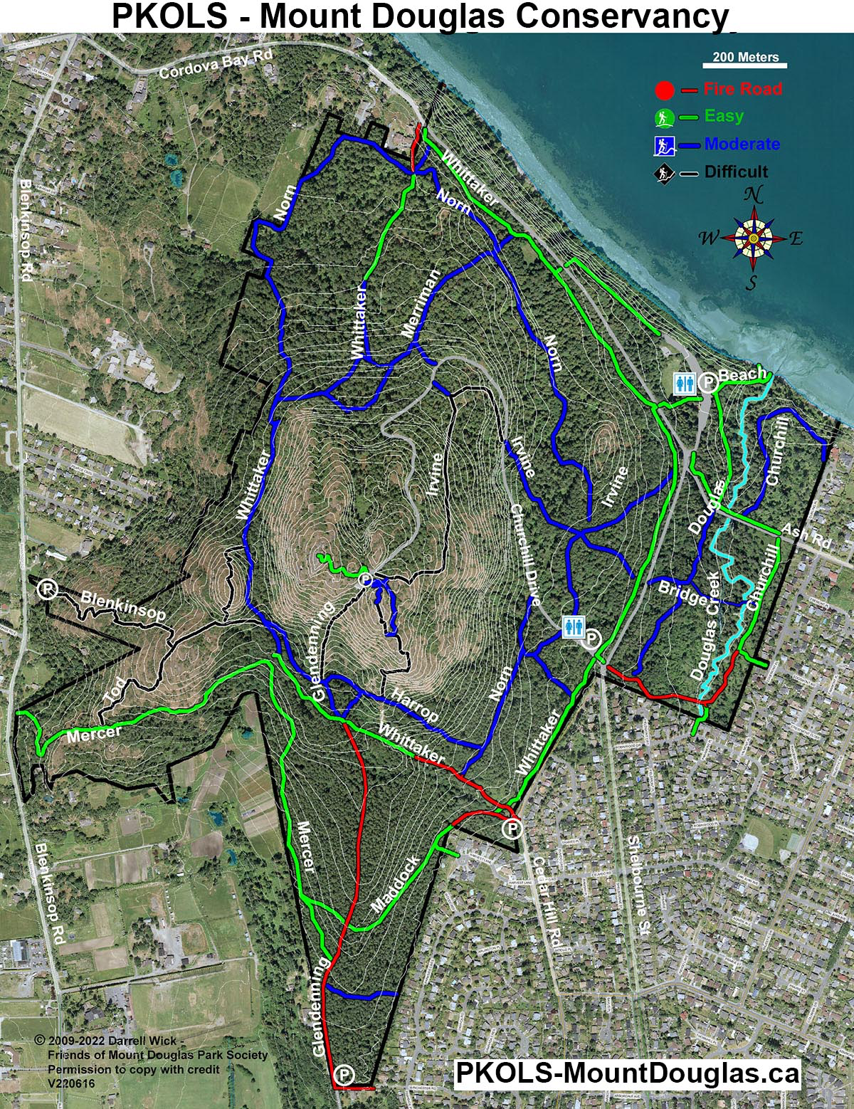
PKOLS – Mount Douglas Conservancy – Trail Maps
If you find these maps useful, please support our society working to preserve PKOLS – Mount Douglas by becoming a member.
GPS Enabled Trail Map
The GPS-enabled map can be loaded onto smartphones (Android or iPhone) using the free “PDF Maps.” Note: This app does NOT use cell data!
- First, download the free app from the Android or iPhone Apps Store.
- Once the app is opened, click on ‘maps’ then the “+” to add a new map, then copy and paste the following link https://PKOLS-MountDouglas.ca/web/Maps/MtDougTrails-2014_ref.tif into the URL entry. (Hint: on smartphones, instead of tapping the above link, hold your finger on the link to bring up a popup menu that allows copying the link URL, which you can then paste into the “From the web” URL).